| Venue & Vicinity:
The workshop will take place in a lecture theatre of the Astronomical
Institute of the Slovak Academy of Sciences. The theatre is spacious
enough to host as many as 50 people, and it is equipped with an over-head
projector, slide projector and a screen. In exceptional cases, we can
also provide an MP 8020 Multimedia Projector (requiring a VGA 640x480 256
colours set-up) for PowerPoint presentations: please, bring along your own
laptop, for no computer will be available for this kind of presentation.
A second, smaller room with a few PC terminals will also be available for
the participants: these computers will offer direct on-line access to the
Internet and should exclusively be used for e-mailing - this service will
be provided free of charge.
The Institute itself is situated at the very border of the Tatra National
Park - the biggest state-protected area in the country. From the one side, the
Institute faces steep and high rocky hills, The
High Tatras, and old, mostly coniferous forests. From the other, it
is surrounded by flat meadows and a shallow valley, the site of two major
towns in the region -
Kezmarok and
Poprad. The Institute
lies only 1km
(a fifteen-minute leisurely walk) apart from the village of Tatranská
Lomnica - one of the most popular tourist and sports resorts in Slovakia.
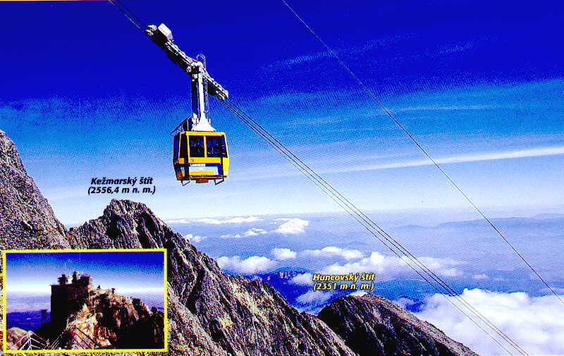
This resort is famous for its biggest all-the-year-round attraction: a
cable car,
whose uppermost station is right at the top of
Lomnický
peak
- some 2,600 metres above sea level.
We have enclosed
a detailed map
of the area, on which the location of the Institute is represented by a
full circle of orange colour: the scale of the map is such
that the diameter of the circle corresponds to 100 meters, and the
Institute lies almost in the centre of the map.
Last modified on August 25, 2001.
Back To
Introductory Page
|
